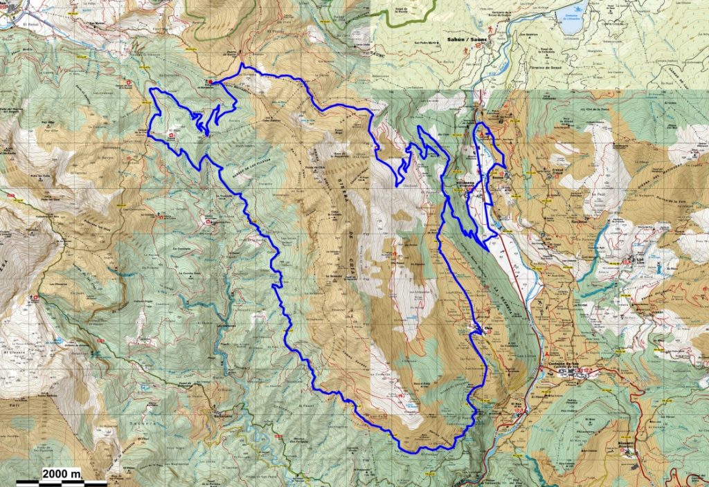
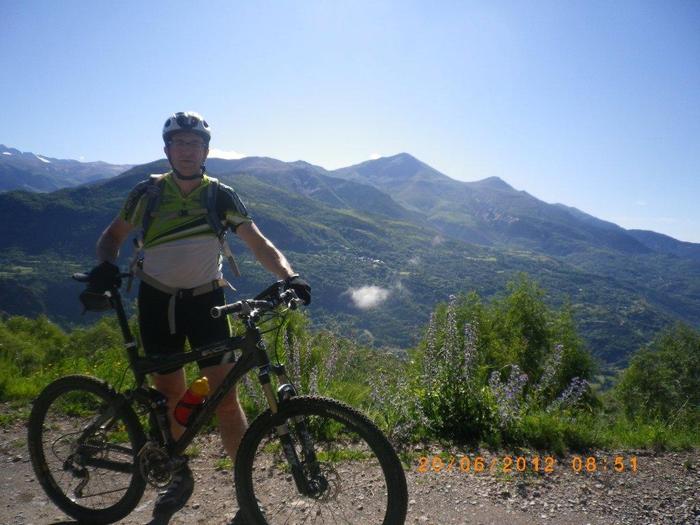
Route that runs along forest tracks with important slopes and trialeras without excessive difficulty, there is also a bit of asphalt (very little). You leave the campsite to go to Villanova along the “abaixo” road of Sesué ; next to the river Ésera, we cross the river by the bridge and after crossing the general road we go up in the direction of the town of Villanova.Before reaching the town hall a forest track on the left (there is an indicative panel of trails) with a rise and fall places us on another forest track with a barrier to the entrance, which goes to the right with some very strong ramps at the beginning, which will then soften a little, although they will make us put the heart to 190 ppm. After a small grassy plain (it is misleading) the climb continues along stony track ramps and on a curve there is another forest track on the right that, after a couple of ramps, leads us to an idyllic place: “Rabaltueras”.
Photo, drink and half turn on the pedaled road. Once we reach the previous turnoff, we continue climbing (right). Soon we arrive at the main track of Plan. Finally, it only remains to go down. We descend by track in very good condition, to reach a point where a road to the left that says “Villanova” leaves. Path with a lot of shade and enjoy not being able to anymore, which leads us to the first track that we have taken at a point that is indicated as “ Arnaldico Cantal ”, we take it in an upward direction and after a ramp that we already knew leads us to another trialera path that can go unnoticed eye! in not very good condition, it takes us to the quarry; From here you can see the campsite. We cross the quarry and soon we reach the track that goes down to the main road and you just have to order the beer at the bar, because there are only 200 m of asphalt left.
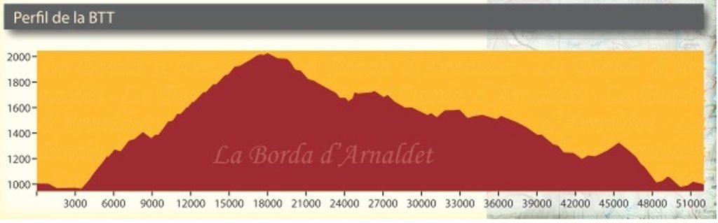
| Estimated time | 5 hours 30 minutes |
|---|---|
| Distance | 51 Km |
| Difficulty | Medium hard |
| Accumulated drop | 1600 m |
| Wikiloc | |
| Google Maps | |
| Download track | |
| Download the file |